Westland District (Westland District)
Westland was originally a part of Canterbury Province, administered from Christchurch in the East coast. The booming population as a result of the gold rush, together with the difficulty of travel and communication across the Southern Alps, led first to the creation of a special Westland County, then the formal separation of Westland from Canterbury to form the short-lived Westland Province (1873–1876). Westland Province also included what is now the southern portion of Grey District with the provincial boundary at the Grey and Arnold rivers. Greymouth proper was in Westland Province, Cobden, on the north bank of the Grey River, was in Nelson Province.
After the abolition of the provinces in 1876, a new Westland County was created with roughly the same borders as the old Province. About this time, the population relative to the rest of the country began to decline, as the easily accessible gold soon ran out and the conditions were not ideal for farming. Local government changes saw the hinterland of Greymouth on both sides of the Grey River transformed into Greymouth Borough and Grey County and subsequently into Grey District, which includes portions of both historical provinces.
However Westland, as a unit of government, emerged largely intact from the local government reforms of the 1980s and 1990s, merely changing from a County to a District and incorporating the Borough of Hokitika.
Recently the population has begun to grow more quickly due to "lifestyle" residents moving into the District.
Map - Westland District (Westland District)
Map
Country - New_Zealand
 |
 |
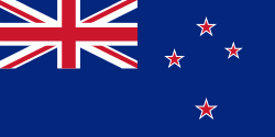
| Flag of New Zealand | |
The islands of New Zealand were the last large habitable land to be settled by humans. Between about 1280 and 1350, Polynesians began to settle in the islands and then developed a distinctive Māori culture. In 1642, the Dutch explorer Abel Tasman became the first European to sight and record New Zealand. In 1840, representatives of the United Kingdom and Māori chiefs signed the Treaty of Waitangi, which in its English version declared British sovereignty over the islands. In 1841, New Zealand became a colony within the British Empire. Subsequently, a series of conflicts between the colonial government and Māori tribes resulted in the alienation and confiscation of large amounts of Māori land. New Zealand became a dominion in 1907; it gained full statutory independence in 1947, retaining the monarch as head of state. Today, the majority of New Zealand's population of 5.1 million is of European descent; the indigenous Māori are the largest minority, followed by Asians and Pacific Islanders. Reflecting this, New Zealand's culture is mainly derived from Māori and early British settlers, with recent broadening of culture arising from increased immigration. The official languages are English, Māori, and New Zealand Sign Language, with the local dialect of English being dominant.
Currency / Language
| ISO | Currency | Symbol | Significant figures |
|---|---|---|---|
| NZD | New Zealand dollar | $ | 2 |
| ISO | Language |
|---|---|
| EN | English language |


